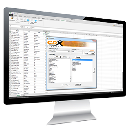
Unlock the Power of Data with the CDXZipStream Excel Add-In
CDXZipStream is your ultimate Excel add-in for harnessing the power of location-based data. Seamlessly integrated with Microsoft Excel, CDXZipStream empowers you to effortlessly perform distance analysis, routing, data visualization, and decision-making. This is all done within your familiar spreadsheet environment. Whether used for distance calculation, radius reports or demographic analysis CDXZipStream is designed to make complex tasks simpler and more efficient.
Try It Now – For Free
The all-in-one tool for
geographic analysis
Whether you need a simple ZIP Code lookup or complex routing
calculation, CDXZipStream can help you get the most out of your
location-based data.
Now supporting Google, Here, Maptitude and Bing Maps
CDXZipStream is compatible with multiple location data providers (Google, Here Technologies, Caliper Maptitude and Bing Maps). CDXZipStream also works with our CDXGeodata web service to correct address lists with USPS Zip+4 data and approved formatting.
Coverage You Need
CDXZipStream offers up-to-date, worldwide coverage with roof-top accuracy. The software can be used to geocode, reverse-geocode, calculate driving distance and time, perform route optimization, verify addresses, look up USPS ZIP and Postal Codes and create maps.
International Support
Databases are available for both the U.S. and Canada. CDXZipStream also supports additional international databases such as Mexico, India and Western European countries
Built For Windows
CDXZipStream works in Excel 2010 for Windows and higher, and comes in several versions to suit your particular needs. Mac users should instead use our CDXGeodata spreadsheet apps or our cloud based Zip+4 Lookup and Demographics tools.
Features and Benefits
Address Verification
Ensure data accuracy with swift address verification.
Geocoding Made Easy
Effortlessly geocode your addresses and perform proximity searches with just a few clicks, enabling you to streamline your location-based analysis and improve data accuracy.
Customizable Data Import
Utilize a comprehensive suite of analysis tools, including radius-based calculations, route optimization, and spatial mapping, to gain valuable insights and make informed decisions.
Customizable Data Import
Import data from a variety of sources. CDXZipStream includes a complete database of US zip codes and demographic data. Postal codes for Canada can be optionally purchased. The product seamlessly downloads data from the web for geocoding and routing from Bing Maps and Here Technologies.
Reliable Data Accuracy
Benefit from high-quality data sourced from reputable providers, ensuring the accuracy and reliability of your analysis and decision-making processes.
Seamless Integration
Seamlessly integrate CDXZipStream with your existing Excel workflows, preserving your investment in Excel while enhancing its capabilities with powerful location-based features.
Extensive Database Coverage
Gain access to an extensive database covering millions of locations across the United States, enabling you to analyze data at various geographic levels with ease.
Ongoing Support and Updates
Receive dedicated support from our team of experts and receive the latest features and enhancements through regular updates and releases.
Pricing
$ 199.95
Basic
Ideal for individual users or small businesses, the Standard Edition of CDXZipStream includes all essential features for location-based data analysis within Excel.
Buy Now$ 399.95
Premium
Designed for advanced users, the Premium Edition offers additional capabilities including extensive databases covering demographic data by state, county, city, CBSA and ZCTA (Zip Code tabulation area). Data is available from the 2000, 2010 and 2020 US Census for both Decennial and yearly ACS (American Community Survey) data.
Buy NowFree Trial
Take your Excel analysis to the next level with CDXZipStream. Try it risk free todayand unlock the full potential of your data-driven decision-making processes.
For inquiries or assistance, contact our sales team at sales@cdxtech.com or visit our website at https://www.cdxtech.com